UN
2 Gordon Road
£ 160,000
Description
We don't have a Description for this property.
- Bedrooms
- 2
- Bathrooms
- 0
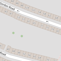


Leaflet © OpenStreetMap contributors
The heatmap indicates the level of crime in the area. The color of the heatmap indicates the crime severity and recency.
Metrics Year-on-Year
- Average area value
- 244,977.00 £Decreased by 7.47 %
- Average area rental value
- 1,119.00 £/moDecreased by 2.27 %
- Est rental Yield
- 5.48 %Increased by 5.59 %
- Crime Rate
- 13.00 %Unchanged by 0.00 %
from 264,750.00 £
from 1,145.00 £/mo
from 5.19 %
from 13.00 %
Nearby Schools
| Name | Type | Ofsted | Distance |
|---|---|---|---|
| Barnsole Primary School | Academy Converter | 0.20 KM | |
| The Gfc School | Other Independent School | Good | 0.47 KM |
| St Mary'S Catholic Primary School | Voluntary Aided School | Good | 0.48 KM |
| Saxon Way Primary School And Children'S Centre | Children's Centre | 0.71 KM | |
| Saxon Way Primary School | Academy Sponsor Led | Good | 0.71 KM |
Images
Nearby Streets
| Name | Average Price | Average Sqft | Distance |
|---|---|---|---|
| Redfern Avenue | £ 300,000 | 0 | 0.00 KM |
| School Avenue | £ 0 | 0 | 0.00 KM |
| Gillingham Road | £ 0 | 0 | 0.00 KM |
| Greenfield Road | £ 0 | 0 | 0.00 KM |
| GB38 | £ 0 | 0 | 0.00 KM |
Nearby Transport
| Name | NLC | TLC | Distance |
|---|---|---|---|
| Gillingham (Kent) | 5169 | GLM | 0.91 KM |
| Chatham | 5199 | CTM | 4.08 KM |
| Rochester | 5203 | RTR | 5.25 KM |
| Rainham (Kent) | 5177 | RAI | 6.26 KM |
| Strood (Kent) | 5191 | SOO | 6.51 KM |
Nearby Listings
| Address | Price | Type | Score | Distance |
|---|---|---|---|---|
| Gordon Road, Gillingham, Kent, ME7 | £ 240,000 | BUY | 5 / 10 | 0.01 KM |
| Gordon Road, Gillingham, ME7 | £ 220,000 | BUY | 7 / 10 | 0.02 KM |
| Livingstone Road, Gillingham, Kent | £ 270,000 | BUY | 6 / 10 | 0.07 KM |
| Livingstone Road, Gillingham, Kent, ME7 | £ 250,000 | BUY | Unknown | 0.08 KM |
| Priestfield Road, Gillingham | £ 250,000 | BUY | 6 / 10 | 0.08 KM |
Nearby Properties
| Address | Price | Distance |
|---|---|---|
| 24 Gordon Road | £ 41,500 | 0.00 KM |
| 48 Gordon Road | £ 119,995 | 0.00 KM |
| 50 Gordon Road | £ 89,500 | 0.00 KM |
| 10 Gordon Road | £ 111,000 | 0.00 KM |
| 62 Gordon Road | £ 131,000 | 0.00 KM |